DMV Hiking Guide
Maryland Heights Trail Guide: Harpers Ferry’s Best Hike
If you only have time for one hike in Harpers Ferry, make it Maryland Heights.
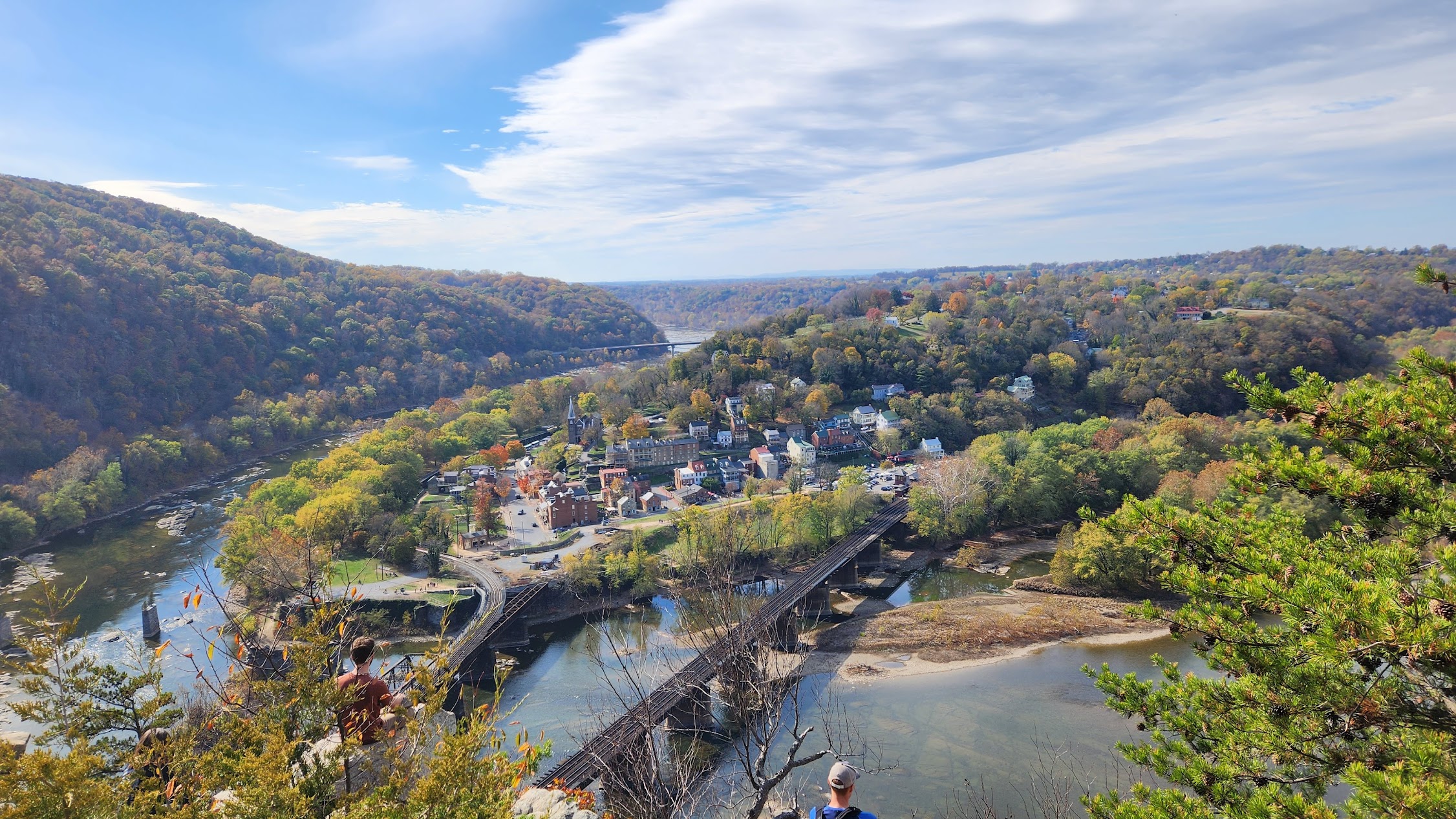
Located about 75 miles from Washington DC, this moderate hike rewards you with one of the most iconic overlooks in the Mid-Atlantic. From the cliffs above town, you can see historic Harpers Ferry, the Potomac and Shenandoah Rivers, railroad bridges, and the surrounding Blue Ridge Mountains.
Unlike more demanding hikes such as Old Rag, Maryland Heights delivers spectacular panoramic views without requiring technical rock scrambling or a full day on the trail. Combined with Harpers Ferry’s history, walkable Lower Town, river views, museums, cafés, and landmarks, it is one of the best day trips from the Washington DC area.
Watch the Maryland Heights Trail Video
This video shows the real hiking experience, including the Visitor Center approach, Lower Town, the pedestrian bridge, the C&O Canal Towpath, the hike through the forest, and the final overlook above Harpers Ferry.
Maryland Heights Trail and Harpers Ferry Video Guide
Watch the footage before hiking to understand the route, trail conditions, Lower Town access, and the overlook experience.
Maryland Heights Trail: Quick Verdict
Maryland Heights is one of the best hikes near Washington DC because it combines four things that are difficult to find in one half-day trip:
- A memorable panoramic overlook.
- A steady but manageable mountain hike.
- Direct access to historic Harpers Ferry.
- River, railroad, mountain, and Civil War scenery in one experience.
The hike is ideal for visitors seeking panoramic views and a rewarding half-day outing without the time and technical demands of Old Rag.
Maryland Heights Trail Facts at a Glance
| Planning Item | What to Know |
|---|---|
| Location | Harpers Ferry National Historical Park, accessed from Lower Town and the Maryland side of the Potomac River. |
| Distance | About 4.5 miles round trip for the main overlook route. |
| Elevation gain | Approximately 1,150 feet. |
| Difficulty | Moderate. |
| Typical time | About 2.5–4 hours, including breaks and time at the overlook. |
| Trail type | Out and back for the most popular overlook route. |
| Dogs | Allowed on leash, subject to current park rules. |
| Best seasons | Spring and fall. |
| Water and restrooms | Not available on the trail. Use facilities at the Visitor Center or in Lower Town. |
Important planning note: Carry enough water, use the restroom before starting, and check current trail conditions and park notices before your visit. Summer heat, winter ice, and weekend crowds can materially change the experience.
Why Maryland Heights Is Harpers Ferry’s Best Hike
Maryland Heights offers a combination of scenery and history that few regional hikes can match. Instead of reaching a typical mountain viewpoint, you look down on one of America’s most recognizable historic towns.
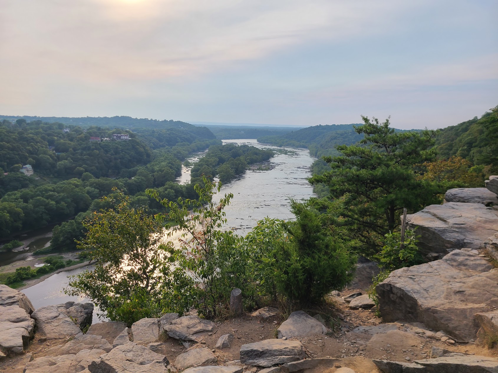
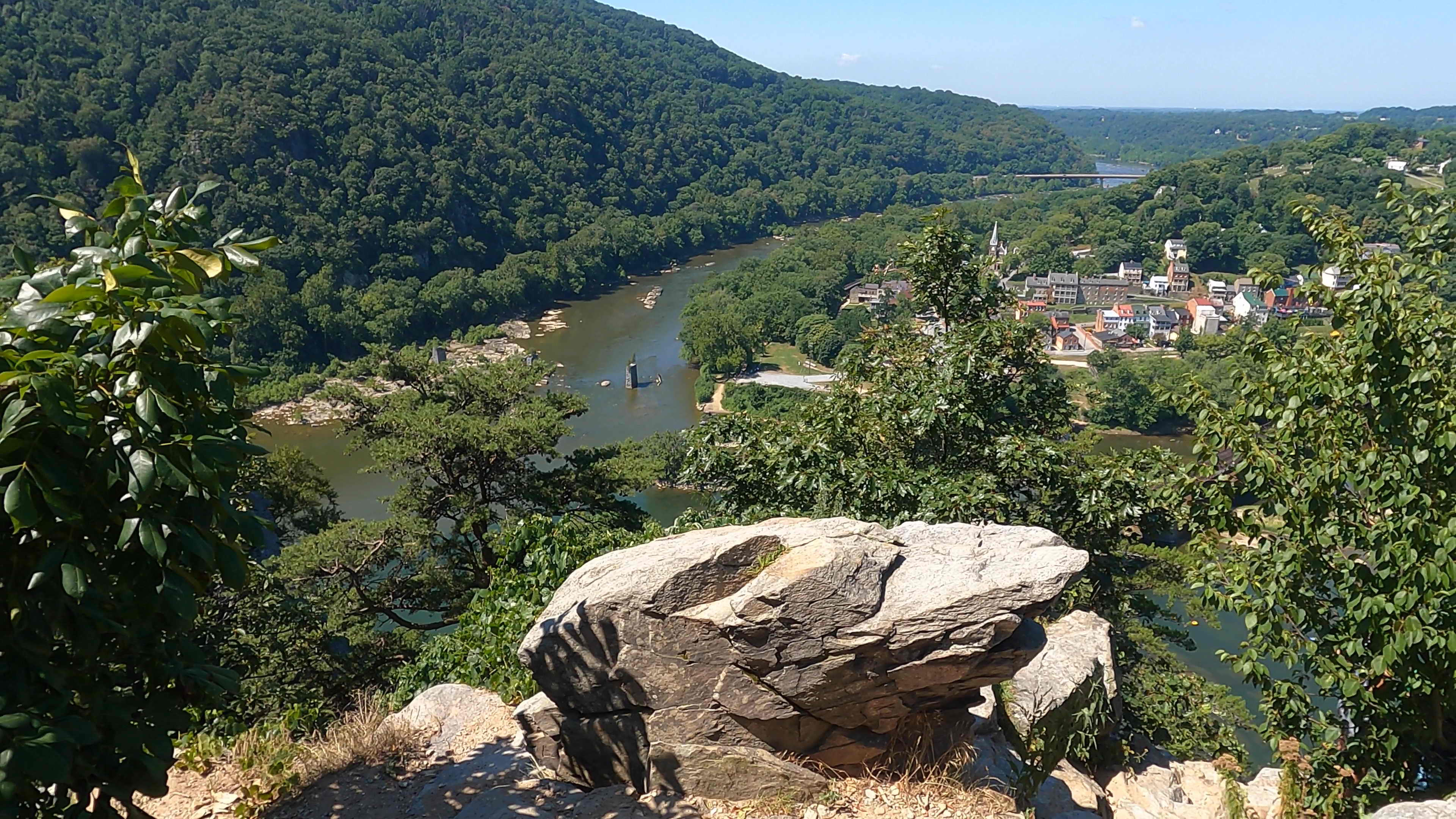
From the overlook, you can see Harpers Ferry below, the meeting point of the Potomac and Shenandoah Rivers, the railroad bridges, and the ridgelines surrounding the town. The view is especially distinctive because natural scenery, transportation history, and Civil War history all occupy the same view.
For a hike within driving distance of Washington DC, the combination of scenery, history, and accessibility is hard to beat.
Parking and Getting to the Maryland Heights Trailhead
The simplest option is to park at the Harpers Ferry Visitor Center and take the park shuttle into Lower Town. The ride normally takes only a few minutes and saves your energy for the hike.
You can also walk from the Visitor Center to Lower Town on a mostly flat route. Depending on your pace, this may take approximately 30 to 60 minutes and adds meaningful time and distance to the day.
Once in Lower Town, walk toward the pedestrian bridge over the Potomac River. Cross the bridge, descend to the Chesapeake & Ohio Canal Towpath, turn upstream, and follow the towpath for about 0.3 miles. Cross the small footbridge over the canal bed and continue to Harpers Ferry Road. The Maryland Heights trailhead is directly across the road.
During spring weekends and peak fall foliage, arrive early. Parking, shuttles, Lower Town streets, and the overlook can all become crowded.
Harpers Ferry Visitor Center Parking and Route from Washington, DC
The map below shows the driving route from central Washington, DC to the Harpers Ferry National Historical Park Visitor Center parking area. This is the most practical place to park before taking the shuttle or walking into Lower Town.
Maryland Heights Trail Overview
One of the best parts of this hike is that the experience begins before you reach the actual trailhead.
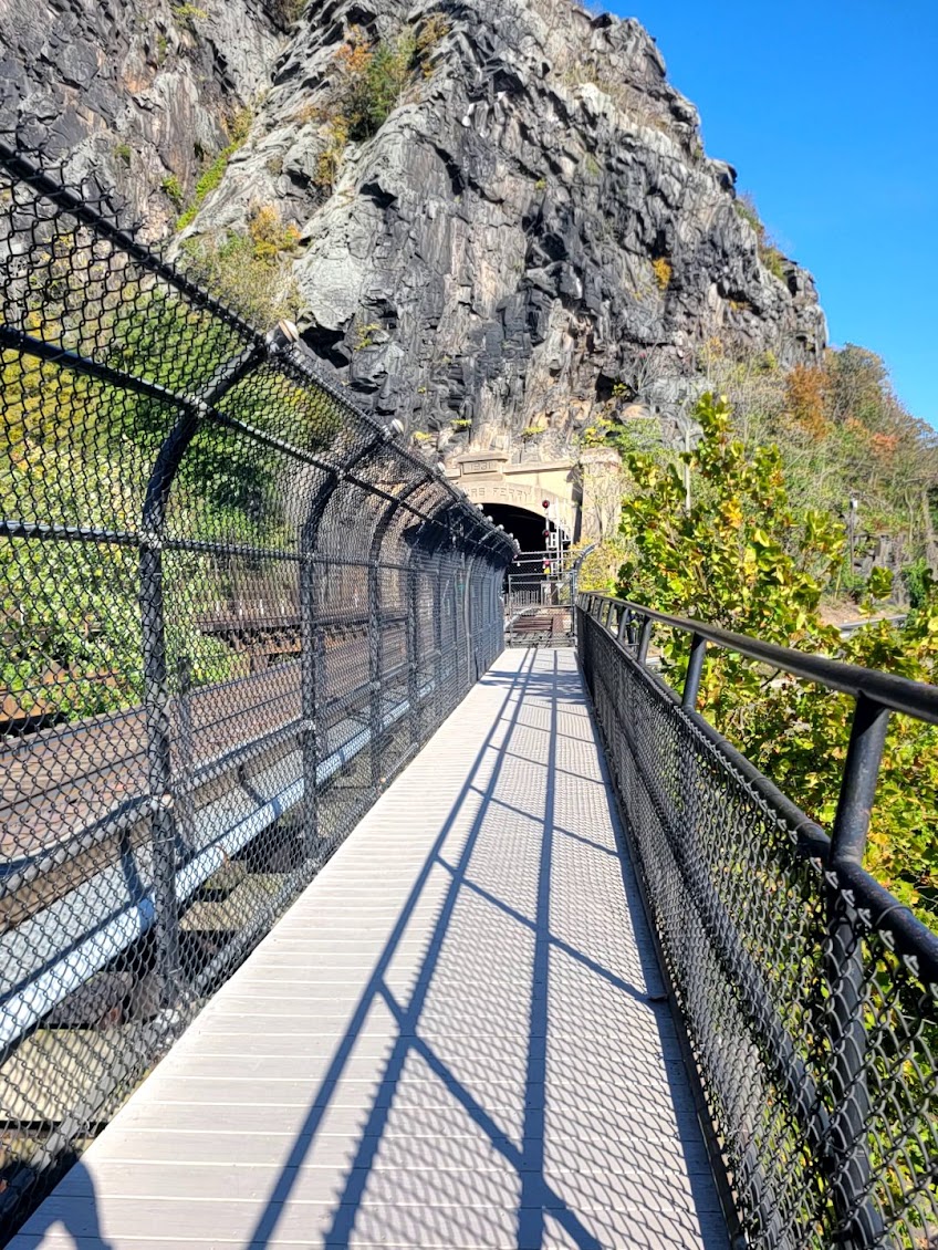
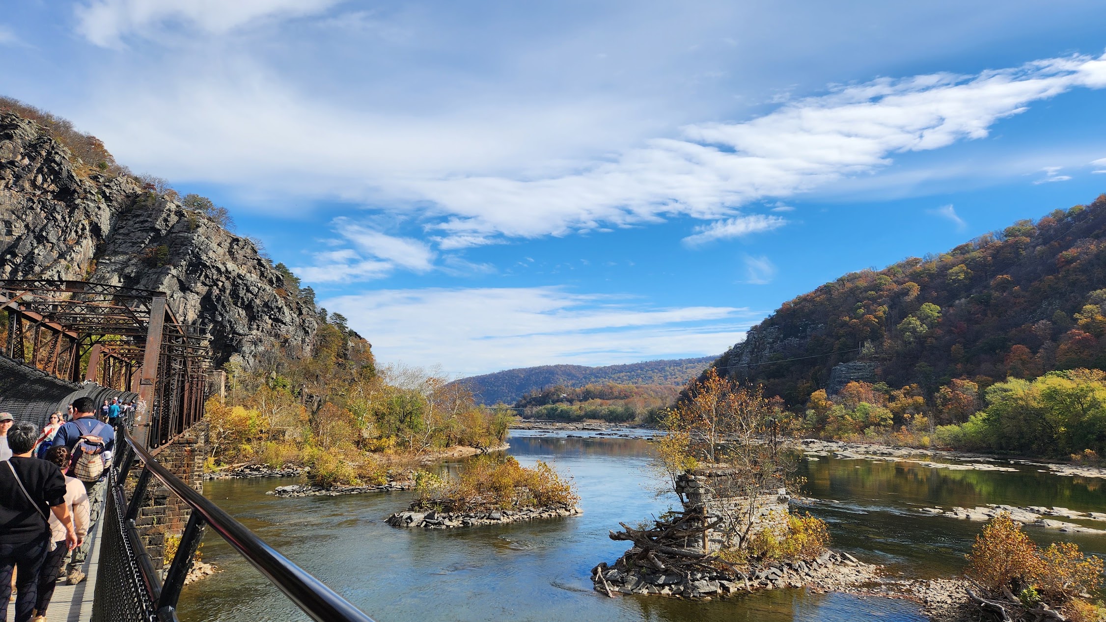
Walking through historic Harpers Ferry gives you a chance to appreciate the town’s unique setting before crossing the pedestrian bridge over the Potomac River. From the bridge, you can see river, railroad, and mountain scenery before descending to the C&O Canal Towpath.
After the short towpath approach, the Maryland Heights Trail begins gaining elevation through a shaded hardwood forest. The trail gains elevation steadily but does not require technical scrambling. It is a sustained uphill hike on a well-established route.
Early in the ascent, you will pass the historic Naval Battery area. It is a worthwhile short detour that connects the hike to Harpers Ferry’s Civil War history.
Continue along the Overlook Trail as it continues above the river. The final approach includes a narrow, rocky descent toward the cliffs before the view suddenly opens over Harpers Ferry.
The overlook is the highlight of the hike. Below you lies the historic town, framed by the Potomac and Shenandoah Rivers as they meet near the Point. Railroad bridges and surrounding ridgelines complete one of the most photographed views in the Mid-Atlantic.
Maryland Heights Hiking Options
There are three practical ways to hike Maryland Heights, depending on where you start and how much of Harpers Ferry you want to include in the day.
Option 1: Lower Town directly to the Maryland Heights Overlook. Start in Harpers Ferry Lower Town, cross the pedestrian bridge over the Potomac River, follow the C&O Canal Towpath to the trailhead, and take the most direct route to the overlook. After enjoying the view, return the same way to Lower Town. This is the shortest and most straightforward option.
Option 2: Lower Town to the overlook via the Stone Fort Trail. Start in Lower Town, cross the Potomac River, reach the Maryland Heights trailhead, and continue through the longer Stone Fort route before reaching the overlook. You finish by descending back toward Lower Town. This option adds distance, elevation gain, and additional historic sites.
Option 3: Visitor Center to the overlook via Lower Town and the Stone Fort Trail. Start at the Harpers Ferry Visitor Center instead of taking the shuttle. Hike along the river toward Lower Town, walk through the historic town, cross the pedestrian bridge, follow the C&O Canal Towpath to the trailhead, and then continue to the overlook through the Stone Fort route. Return the same general way to the Visitor Center. This is the longest and most complete Harpers Ferry hiking experience because it combines hike along the river, historic Lower Town, and the full Maryland Heights hike.
| Route | Approximate Distance | Approximate Time | Approximate Elevation Gain | Best For |
|---|---|---|---|---|
| Lower Town to Maryland Heights Overlook | About 4.5 miles round trip | About 2–3.5 hours | About 1,150 feet | Shorter hike directly to the overlook. |
| Lower Town to Overlook via Stone Fort Trail | About 6–7 miles round trip | About 3.5–5 hours | About 1,500 feet | Longer hike to the overlook via Stone Fort. |
| Visitor Center to Overlook via Lower Town and Stone Fort Trail | Up to about 9.5 miles round trip | About 5–6.5 hours | About 1,770 feet | Longest hike from the Visitor Center, including hiking along the river, walking through town, and continuing to the Maryland Heights Trail. |
How Difficult Is Maryland Heights?
Maryland Heights is moderately difficult. The main route does not include the technical scrambling found on Old Rag or Billy Goat Trail Section A, but the steady elevation gain can feel demanding.
The difficulty comes from the steady elevation gain rather than complicated terrain. Hikers who are comfortable with moderate day hikes should find the overlook route manageable, and the trail does not require technical scrambling.
If you have completed Mary’s Rock comfortably, Maryland Heights should feel comparable. Billy Goat Trail Section A is more technical because of the scrambling, while Old Rag is substantially more demanding overall.
Maryland Heights Compared With Other Popular DMV Hikes
| Trail | Comparison |
|---|---|
| Great Falls overlooks and river trails | Easier. |
| Billy Goat Trail Section A | Similar overall effort for some hikers, but Billy Goat is more technical because of scrambling. |
| Mary’s Rock | Similar sustained hiking effort. |
| Maryland Heights | Moderate, steady hike with no major technical scramble. |
| Old Rag | Longer, more strenuous, and significantly more technical. |
Best Time to Hike Maryland Heights
Spring
Spring offers cool temperatures, wildflowers, fresh green forest, and comfortable hiking conditions. It is one of the best seasons for the hike.
Summer
Summer can be hot and humid. Start early, carry extra water, and avoid the hottest part of the afternoon. Much of the trail is shaded, but summer heat and humidity can still make the hike more demanding.
Fall
Fall is arguably the most scenic season. The overlook becomes even more dramatic when the surrounding ridges change color. Expect heavy crowds on peak foliage weekends.
Winter
Winter can provide wider visibility through leafless trees and a quieter trail. Use caution after snow or freezing rain because shaded sections may remain icy.
What to Bring for Maryland Heights
- Enough water for the full hike.
- Hiking shoes or trail shoes with good traction.
- Weather-appropriate layers.
- Sun protection.
- Snacks.
- A downloaded trail map.
- A fully charged phone.
- Trekking poles if you prefer extra support on the descent.
No Water or Restrooms on the Trail
Drinking water is not available on the Maryland Heights Trail, and there are no restrooms once you leave Lower Town. Use the Visitor Center or Lower Town facilities before beginning the hike and carry enough water for the conditions.
Explore Harpers Ferry After the Hike
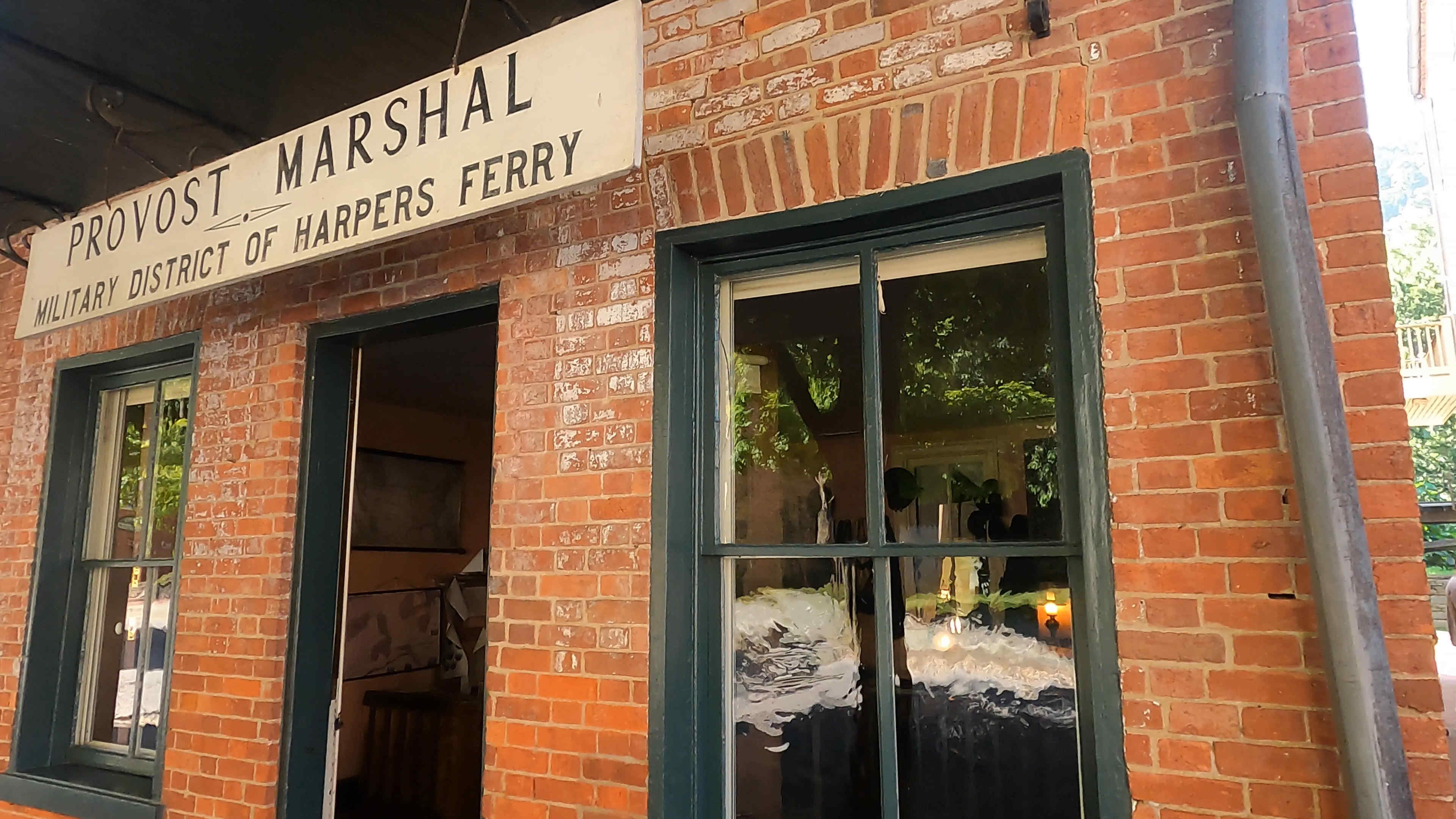
Do not rush home after reaching the overlook. One of the biggest advantages of hiking Maryland Heights is that the trail connects directly to one of the most interesting historic towns in the region.
Popular stops include:
- The Point, where the Potomac and Shenandoah Rivers meet.
- John Brown’s Fort.
- Historic Lower Town.
- White Hall Tavern.
- Harpers Ferry Station.
- National Park Service museums.
- Local cafés, restaurants, and ice cream shops.

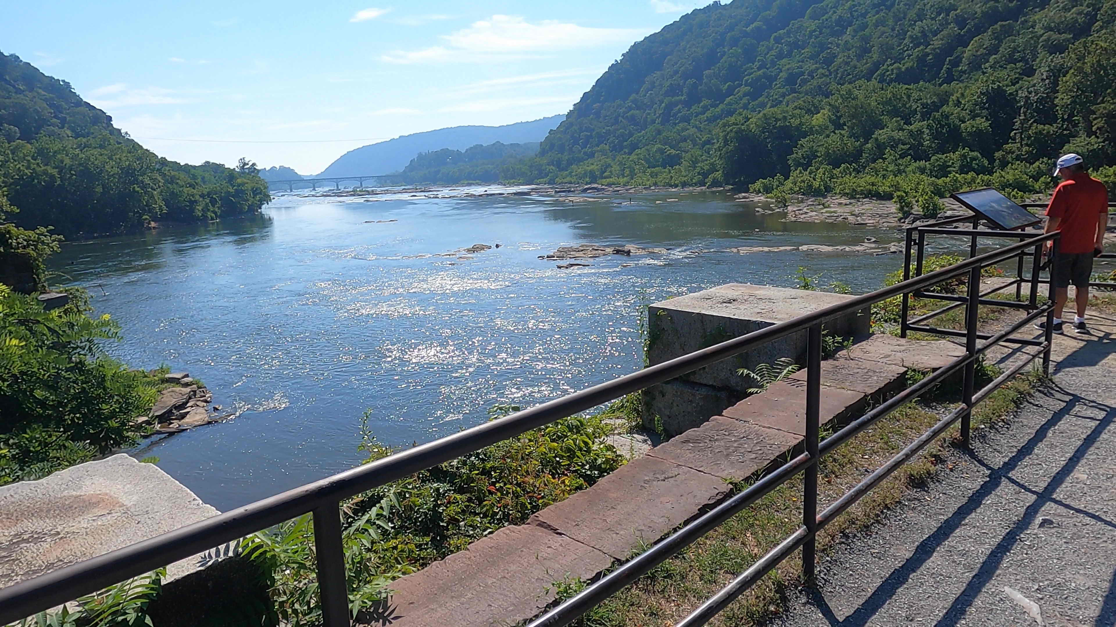
The Point is especially worth visiting. From river level, it offers a different perspective on the same landscape seen from the overlook and is one of the best places in town for photographs.
Maryland Heights vs Old Rag
Choose Maryland Heights if you want a scenic half-day hike, moderate difficulty, no major rock scramble, historic attractions nearby, and a day that combines hiking with sightseeing.
Choose Old Rag if you want a full-day challenge, extended rock scrambling, a more strenuous mountain objective, and a deeper Shenandoah wilderness experience.
Is Maryland Heights Worth It?
Yes. Maryland Heights is absolutely worth hiking for visitors who want one of the best views in the Mid-Atlantic without committing to a full-day technical adventure.
The trail combines a rewarding hike, a dramatic overlook, river scenery, Civil War history, and a complete Harpers Ferry day trip. Few hikes near Washington DC offer this much variety in one outing.
Final Verdict: Is Maryland Heights Harpers Ferry’s Best Hike?
For most visitors, yes.
Maryland Heights offers the strongest combination of scenery, accessibility, history, and effort in Harpers Ferry. The hike offers a satisfying level of effort while remaining accessible to many regular day hikers. The overlook is one of the most memorable in the region, and Lower Town gives you a full day of attractions after the hike.
If the weather is comfortable, the trail is dry, and you arrive early enough to avoid the largest crowds, Maryland Heights is one of the best hiking experiences near Washington DC.

About the Author
Andy Newman is the founder of Next Outdoor Adventures. Andy has been hiking in many of the most popular national parks for over a decade, with notable hikes including Bright Angel Trail at the Grand Canyon, Bryce Canyon, Zion, Acadia, Rocky Mountain National Park, the Smoky Mountains and more.
As a Maryland resident, Andy continues to explore and document iconic outdoor locations in the DMV area, including Shenandoah National Park, Great Falls and Upstate New York.
Frequently Asked Questions About Maryland Heights
How difficult is the Maryland Heights Trail?
The main overlook route is moderately difficult. It gains elevation steadily and includes about 1,150 feet of elevation gain, but it does not include the major technical scrambling found on Old Rag or Billy Goat Trail Section A.
How long is the Maryland Heights hike?
The popular overlook route is about 4.5 miles round trip. Most hikers should allow 2.5 to 4 hours, including breaks and time at the overlook.
Where should I park for Maryland Heights?
The simplest option is to park at the Harpers Ferry Visitor Center and take the park shuttle into Lower Town. From there, cross the pedestrian bridge over the Potomac River and follow the C&O Canal Towpath to the trailhead.
Can I walk from the Visitor Center instead of taking the shuttle?
Yes. The mostly flat walk into Lower Town may take approximately 30 to 60 minutes, depending on pace, and adds time and mileage to the day.
What is the best time to hike Maryland Heights?
Spring and fall usually offer the best conditions. Summer can be hot and humid, while winter may bring snow or ice.
Is there water or a restroom on the trail?
No. Use facilities at the Visitor Center or in Lower Town and carry enough water for the hike.
Is Maryland Heights harder than Old Rag?
No. Old Rag is longer, more strenuous, and includes substantial rock scrambling. Maryland Heights is a shorter, moderate hike with steady elevation gain.